

‘On Angel’s wings.’ The photographer wrote, “I’ve done my share of gruelling hikes, long monotonous, twist your ankles hikes, but this one stands out on it’s own though it was a short 5 mile hike. Angels Landing trail of Zion National Park is something to behold. Aptly named so because when Zion was initially explored, no one belived they could get to there unless it was an Angel on his wings. Then the demons made a trail to the top of it. And us urchins scrambled along to the holy sanctuary.” Photo #1 by Joseph Dsilva

The Narrows, Zion NP. Photo #2 by Christian Schirm

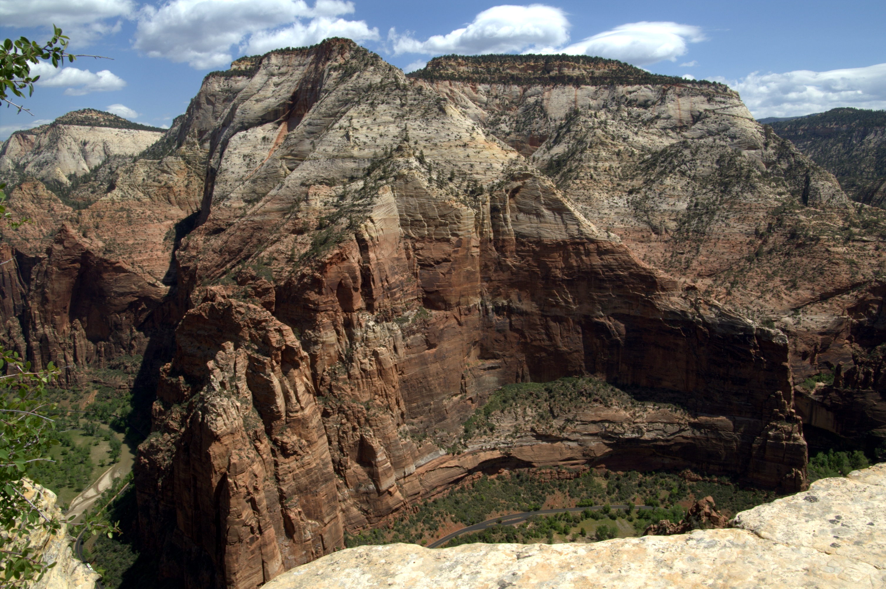
Canyon at sunset in Zion National Park as seen from Angels Landing looking south. Photo #3 by Diliff
 from the Angels Landing trail looking northward to the Narrows, ZNP")
Breathtaking view from the Angels Landing trail looking northward to the Narrows. Zion protects the incredible rock formations and high sandstone cliffs and has been said to have some of the most spectacular trails in the national park system. Photo #4 by Tobias Alt

Entrance to Zion National Park, a favorite park for hiking, backpacking, canyoneering and climbing. Photo #5 by Doug Dolde

Kolob Arch in Zion’s backcountry may be the second longest in the world. “Located deep in the backcountry of Zion National Park’s Kolob Canyons District, and hidden in a small side canyon, sits Kolob Arch, perched high on the canyon wall with a majestic curve like a giant condor’s wing,” wrote NPS. “Because of its remote location and virtual inaccessibility, Kolob Arch for years has challenged cowboys, rangers, hikers, climbers, and photographers alike.” Photo #6 by Zion NPS

According to Wikipedia, “The Three Patriarchs in Zion CanyonThe Three Patriarchs are visible from the Zion Canyon Visitor Center and Watchman Campground Area. The massive cliffs consist of Lower Jurassic-age formations, including (from bottom to top): the Moenave Formation, the Kayenta Formation, and the massive Navajo Sandstone. These Jurassic-aged cliff-forming formations overlie older slope-forming formations along river level: the Moenkopi Formation (Lower Triassic) and the Chinle Formation (Upper Triassic). The cliffs tops in Zion Canyon range roughly 2,000 feet above stream level.” Photo #7 by Daniel Mayer

Amazing Big Bend. Photo #8 by wallpaperweb

High canyon walls and water at ZNP. Photo #9 by Paradise in the World

Early Fall, looking out from the Temple of Sinawava. Photo #10 by Carl Berger

View from entrance of “The Subway.” There are two ways to hike the Subway, also known as the Left Fork, but both routes require a permit. Hiking from the bottom and back is a 9 mile hike, often slippery, requring route finding, stream crossings, and scrambling over boulders. NPS also says the top down route “is a strenuous 9 and one half mile hike requiring rappel skills and 60 feet of rope or webbing. This route also requires swimming through several deep pools of very cold debris filled water.” Photo #11 by God of War

Inside the Subway. It’s been a called “don’t miss” part of the park where fairy-tale meets real life. Photo #12 by scenic reflections

Virgin River at Zion can experience flash floods. Photo #13 by David Scarbrough

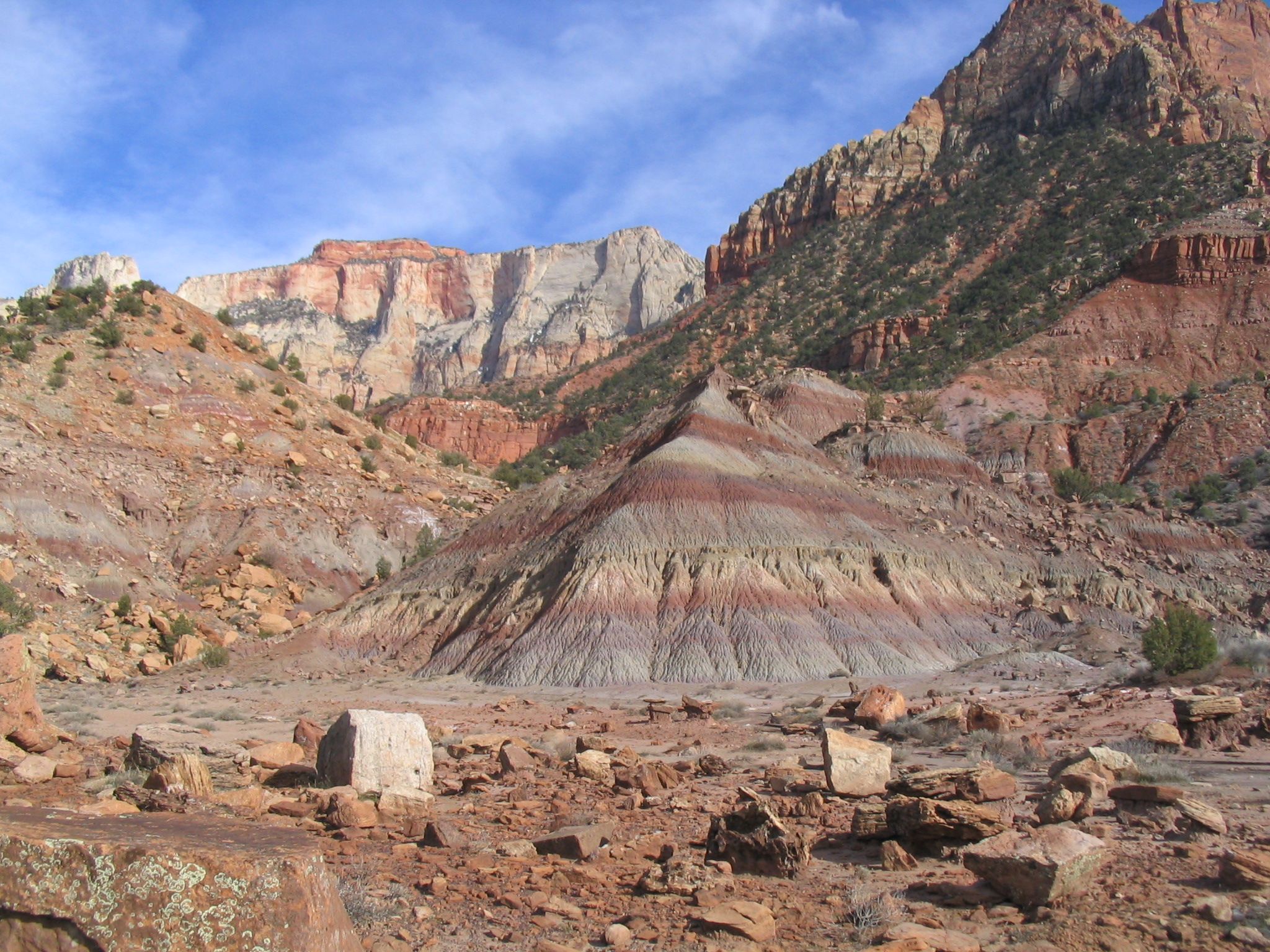
Zion Canyon. NPS stated, “Zion National Park is located along the edge of a region known as the Colorado Plateau. The rock layers have been uplifted, tilted, and eroded, forming a feature called the Grand Staircase, a series of colorful cliffs stretching between Bryce Canyon and the Grand Canyon. The bottom layer of rock at Bryce Canyon is the top layer at Zion, and the bottom layer at Zion is the top layer at the Grand Canyon.” Photo #14 by Manderson164

Hidden Canyon trail. Photo #15 by blue_i’s

Rock climbers explore Zion Canyon’s vertical world. Popular “short walls” for rock climbing include Touchstone, Moonlight Buttress, Spaceshot, and Prodigal Son.Photo #16 by ZionNPS

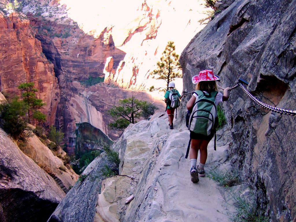
An interpid hiker descends the Angels Landing route with near 1000 foot drops on both sides. Do people fall? Oh yes. NPS says this is an incomplete list of fatalities from “falling” in Zion National Park: Angels Landing = 5; Cathedral Mountain = 1; Emerald Pools = 7; Lady Mountain = 2+; Mt. Kinesava = 1; Mt. of the Sun = 1; Observation Point = 2; Watchman = 2; East Rim Trail = 1; Checkerboard Mesa = 1; Crazy Quilt Mesa = 1; Deer Trap Mountain = 1; Hidden Canyon = 2; Canyon Overlook = 2. Photo #17 by NPS / Caitlin Ceci

Autumn colors and red Navajo Sandstone. NPS Did You Know: During the summer or fall, you may see a tarantula crossing a road or trail in Zion National Park. But don’t be frightened– tarantulas are actually amazing arachnids–gentle, basically harmless creatures that have suffered a bum rap Photo #18 by ZionNPS / Jonathan Fortner

Kolob Canyons from end of Kolob Canyons Road. The canyon walls rise 2,000 to 3,000 feet above the canyon floor in some places. Photo #19 by Daniel Mayer

Curious Rock Climber: Big Horn Sheep. Photo #20 by James Marvin Phelps

Lightning strikes over Zion. Photo #21 by Owips

A winding road in the park. Photo #22 by Wolfgang Staudt

Angels Landing, looking way down to the ground. Photo #23 by Tobias Alt

Looking up at the cliffs of Zion canyon from the Emerald Pools trailhead. Photo #24 by PDPhoto.org

Mount Majestic. Photo #25 by James Forsyth
")
The Left Fork (The Subway). Water continues to carve out this slot canyon, known as The Subway. Access to this backcountry area requires advanced technical skills. Photo #26 by ZionNPS / /Jonathan Fortner

Observation Point as seen from the top of from Angels Landing. The trail (switchbacks) leading on top of Observation Point can be seen to the right. Photo #27 by Aneta Kaluzna

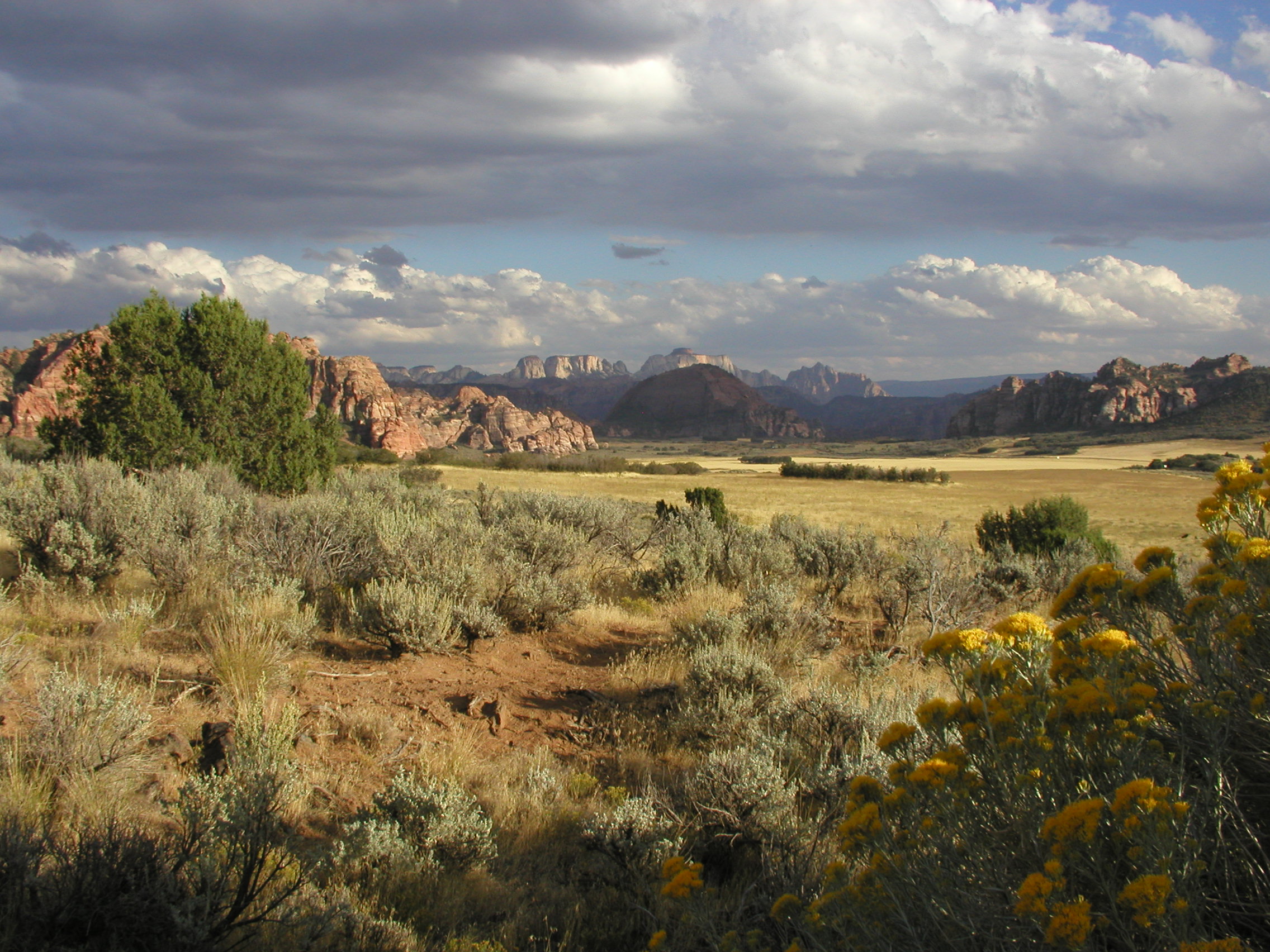
Before there was a Zion National Park, which was established in 1919, people have called the canyons and plateaus “home” for over 10,000 years. Photo #28 by LeavXC

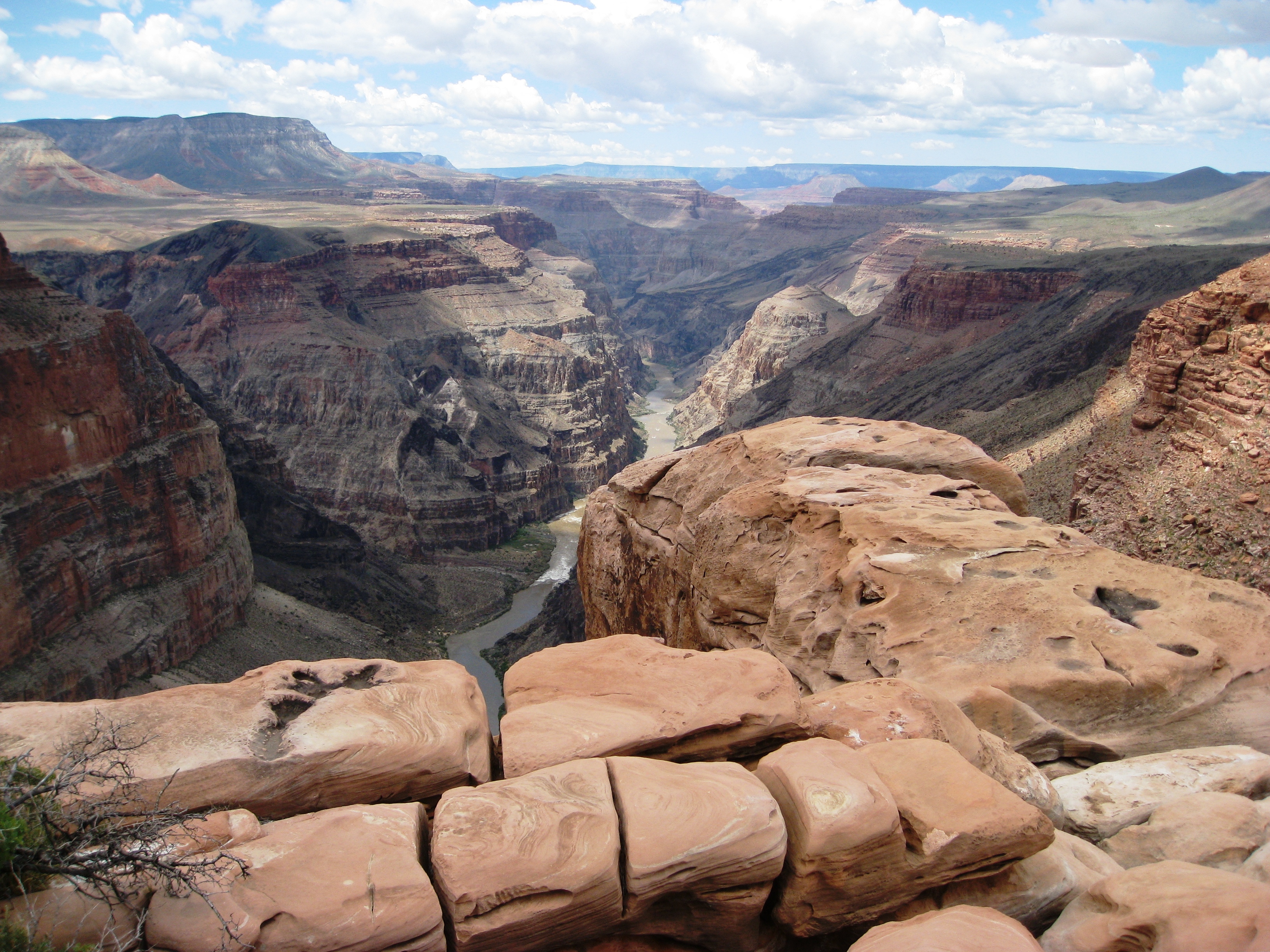
Wikimedia has Toroweap listed as part of Zion under Hurricane Cliffs and Hurricane Fault. The View from Toroweap Overlook is breathtaking. 3,000 vertical feet above the Colorado River is the dramatic sheer drop. From the west side of the Toroweap area. There is about a 900 meter (3000 foot) drop to the Colorado river. Toroweap Point, 6,293 feet (1,918 m), is at the southeast of Toroweap Valley, mostly a due-north trending valley, north side Colorado River, Grand Canyon, with small Uinkaret Mountains. Photo #29 by J Brew

Crawford Arch overlooking Human History Museum. NPS reports, “Among the many arches in Zion, two stand out: Crawford Arch and Kolob Arch. Crawford Arch is the most visible, clinging to the base of Bridge Mountain a thousand feet above the canyon floor, and pointed out to casual observers by an interpretive sign located on the front patio of the Human History Museum.” Photo #30 by NPS / Chad Utterback

Winter in Zion — Snowmelt often creates winter waterfalls like this one near Weeping Rock. Photo #31 by NPS

Mount Spry and the East Temple from the Mount Carmel highway. Photo #32 by Óðinn

The Watchman and the Virgin River at Zion National Park. Photo #33 by Doug Dolde

Kolob Terrace. Photo #34 by NPS

Heard of buffalo watching over the young just outside the east entrance of ZNP. Photo #35 by James Marvin Phelps

Chinle Trail. Photo #36 by NPS

The Grand Canyon, from about Mohawk to Whitmore Canyons, below the Uinkaret Volcanic Field, and the lava flow over the rim (center left) from this volcanic field (center top). The lava flow into the gorge is:Lava Falls, and creates one of the major river rapids, Lava Falls Rapids. The site is downdropped (to west, left) from the:Toroweap Fault. The Hurricane Fault (to southwest Utah, Hurricane Cliffs), begins here, and strikes west along the west side of the (small) Uinkaret Mountains-(north, Mount Trumbull Wilderness); the Toroweap Valley is just east. The Toroweap Fault strikes along the east of Toroweap Valley going north into border region of Utah. Across the river, south, the Aubrey Cliffs, (east border of Toroweap Fault), strikes south towards Aubrey Valley, and Seligman, AZ. The Aubrey Cliffs are the west perimeter of the Coconino Plateau. Photo #37 by Doc Searls

Checkerboard Mesa in Zion National Park. Photo #38 by Daniel Mayer

East Temple – Overlook Trail. Photo #39 by Óðinn

Waterfall beyond Double Arch Alcove on Taylor Creek Trail. Photo #40 by Andy Withers

Sleek stands of quaking aspens (Populus tremuloides) grow in Zion’s higher elevations. Photo #41 by

Upper Emerald Pool. The Emerald Pools were rushing with water as rain and snow continued to fall on April 14th, 2012. Photo #42 by NPS / Jonathan Fortner

The Subway in Fall. Photo #43 by John Fowler

Two mountain lions hunt prey while visitors sleep. According to ZNP, “With elevations ranging from roughly 3800 feet to 8800 feet, the Park encompasses 5000 feet of elevation change in 148,000 acres. With so many varying heights and resultant microclimates and habitats, it is no surprise that Zion is home to over 78 species of mammals, 291 species of birds, 44 species of reptiles and amphibians, and 8 species of fish.” Photo #44 by NPS

Nighttime is a beautiful time to be in Zion Canyon, especially under a full moon. Temperatures are cooler at night, and in the moonlight the rich
colors of the cliffs are visible. Photo #45 by NPS / Rebecca Alfafara
수정 버튼은 저는 보이는데요!!
이건 제가 그냥 카피해서 paste한건데요, 싸이즈 수정이 가능한가요??